Tour Auto Glenties Municipal District - Sleepy Hollows Boucle - Photo
© OpenStreetMap contributors
Länge
Länge
89 km
Maximale Höhe
Maximale Höhe
281 m
Positive Höhendifferenz
1099 m
Km-Effort
Km-Effort  
104 km
Min. Höhe
Min. Höhe
8 m
Negative Höhendifferenz
1099 m
Boucle
Boucle
Ja
Erstellungsdatum :
2021-10-11 15:37:34.553
Letzte Änderung :
2021-10-11 20:33:06.018

(0 Nachricht)

Auto
Auto
--
Schwierigkeit : Sehr leicht

Scannen Sie diesen QR-Code, um die Tour in der SityTrail-Anwendung zu öffnen

Kostenlosegpshiking-Anwendung

Logo SityTrail SityTrail

IGN / Geografische Institute

SityTrail aus dem App Store herunterladen SityTrail von Google Play herunterladen

Logo SityTrail SityTrail World

Die Welt öffnet sich für Sie

SityTrail aus dem App Store herunterladen SityTrail von Google Play herunterladen SityTrail auf Huawei AppGallery herunterladen

Über SityTrail

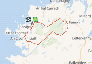
Tour Auto von 89 km verfügbar auf Unbekannt, County Donegal, Glenties Municipal District. Diese Tour wird von Bernard Lejeune vorgeschlagen.

Höhenprofil

Ort

Land:
Ireland
Region :
Unbekannt
Abteilung/Provinz :
County Donegal
Kommune :
Glenties Municipal District
Standort:
Annagary ED
Gehen Sie:(UTM)
546588 ; 6098374 (29U) N.

Touren in der Umgebung

Tour Auto Glenties Municipal District - Sleepy Hollows - Letterkenny. WAW Part 12 - Photo
Auto
Bernard Lejeune

Auto

Sehr leicht
Glenties Municipal District, Unbekannt, County Donegal, Ireland
181 km | 213 km-effort
Unbekannt
Nein


Schließen
Meine Abonnements